Underground Utility Locating
Underground mapping provides our clients with the ability to map hard-to-reach pipelines with a sophisticated and versatile lateral and mainline probe.

We are an international probe, camera and drone service provider for the oil and natural gas, landfill, utility and construction industries.
We are a qualified COSTARS vendor.
RAVAN AIR is an international inspection company offering turnkey Advanced Integrated Resources to complete even the most complex projects. We specialize in probes for underground distribution and transmission pipeline mapping and cameras for underground imaging and inspection. RAVAN AIR’s services are primarily focused in the utility industry.
Additionally, we offer complete UAV services including GIS mapping, oil and gas leak detection, thermal imaging, aerial and above ground inspections and UAV for emergency management.
Many of these services are transferable to the utility infrastructure, industrial, construction, landfill and telecommunications industries. Our team holds many certifications, including NASSCO PACP, MACP and LACP certifications.


Underground mapping provides our clients with the ability to map hard-to-reach pipelines with a sophisticated and versatile lateral and mainline probe.

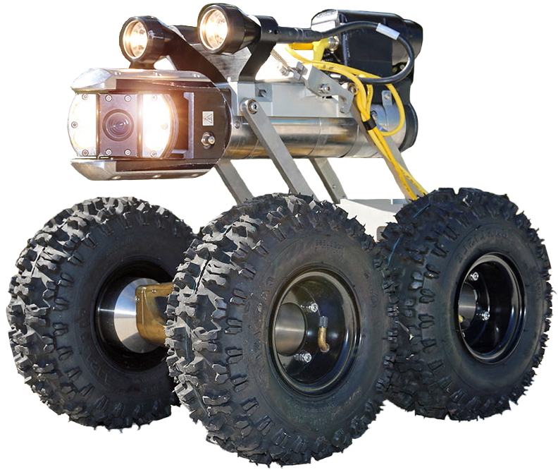
Our profiling system is a multi-sensor inspection powerhouse equipped to float, crawl or push through thousands of feet of pipe.

It’s designed to make any underground utility project easier and more accurate with a gyroscopic and autonomous probe, easily relaying the XYZ location of your pipeline project.

We are able to quickly and non-invasively deploy our underground probe and camera in order to pinpoint the exact location of the damage and receive immediate and detailed visuals.

CCTV visual underground pipeline inspection is the most effective way to assess the condition of the pipeline to monitor degradation and avoid costly emergency repairs.

Our drones detect gas leaks with drone-scanner technology, the best UAV gas detection system on the market.

We safely collect point cloud data and photogrammetric images transforming them into survey-quality, color 3D models and maps, with optional volumetric measurements with georeferenced 2D maps and 3D models.

Unreachable pipe and dangerous locations have become accessible with our hearty drone equipped with an infrared camera payload. Our nighttime waiver enables flight without daylight constraints.
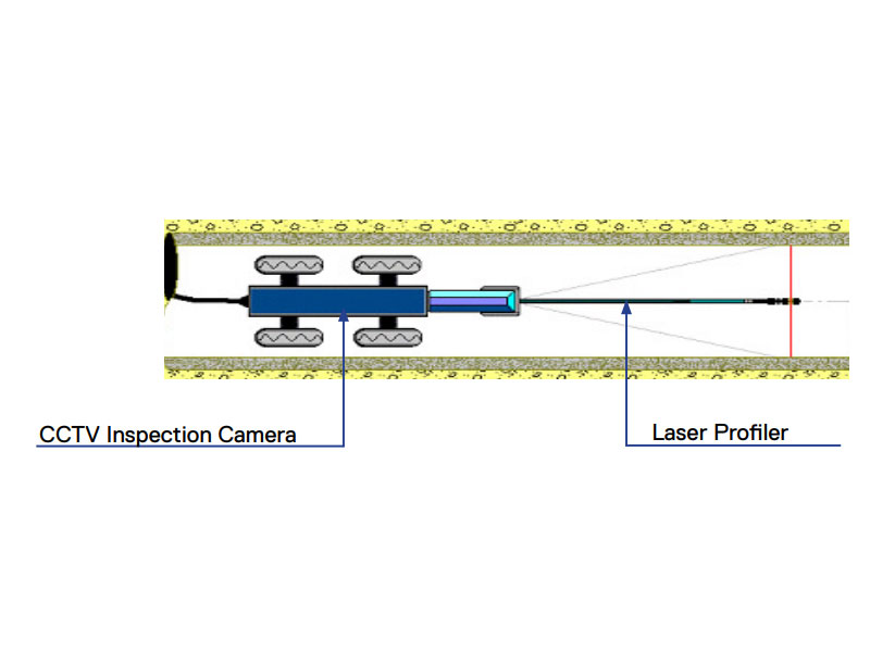
Laser Profiling allows us to provide our customers with a digital pipe profile using a ring of laser light that projects onto the internal pipe surface.